



Finding Slope Flying Sites
Dave Garwood
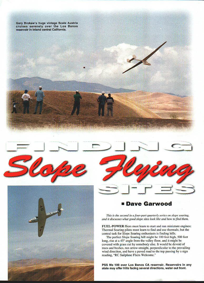
This is the second in a four-part quarterly series on slope soaring, and it discusses what good slope sites look like and how to find them.
Fuel-power fliers must learn to start and run miniature engines; thermal soaring pilots must learn to find and use thermals; but the central task for slope soaring enthusiasts is finding hills.
The perfect slope soaring hill might be 100 feet high, 500 feet long, rise at a 45° angle from the valley floor, and it might be covered with grass cut by somebody else. It would be devoid of trees and bushes, run arrow-straight, perpendicular to the prevailing wind direction, and have a paved road to the top passing by a sign reading, "RC Sailplane Fliers Welcome."
That hill exists only in our imaginations, but there are plenty of hills with enough of these characteristics to be quite flyable.
Slope pilots are seekers: looking out the car window when driving, studying topographic maps to find hills they can't see from the main roads, and asking their outdoorsman friends where undiscovered flying hills might be.
Important Characteristics of a Good Hill
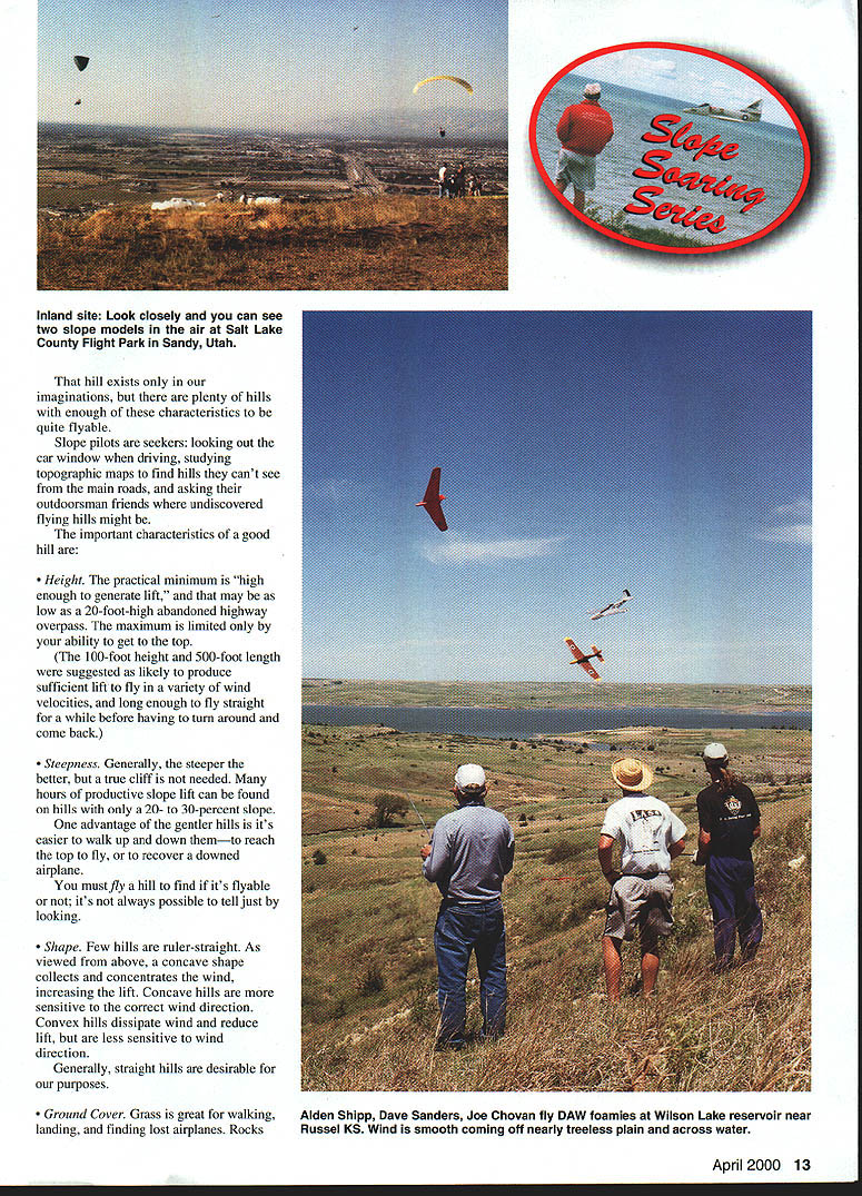
- Height. The practical minimum is "high enough to generate lift," and that may be as low as a 20-foot-high abandoned highway overpass. The maximum is limited only by your ability to get to the top. (The 100-foot height and 500-foot length were suggested as likely to produce sufficient lift to fly in a variety of wind velocities, and long enough to fly straight for a while before having to turn around and come back.)
- Steepness. Generally, the steeper the better, but a true cliff is not needed. Many hours of productive slope lift can be found on hills with only a 20- to 30-percent slope. One advantage of the gentler hills is it's easier to walk up and down them—to reach the top to fly, or to recover a downed airplane. You must fly a hill to find if it's flyable or not; it's not always possible to tell just by looking.
- Shape. Few hills are ruler-straight. As viewed from above, a concave shape collects and concentrates the wind, increasing the lift. Concave hills are more sensitive to the correct wind direction. Convex hills dissipate wind and reduce lift, but are less sensitive to wind direction. Generally, straight hills are desirable for our purposes.
- Ground Cover. Grass is great for walking, landing, and finding lost airplanes. Rocks...
I can't find any continuing article text on this scanned page — it contains only photos with captions. Do you want me to extract and correct the photo captions, or should I skip this page and move to the next?
Finding Slope Sites
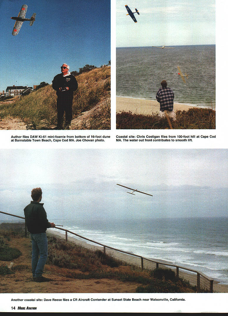
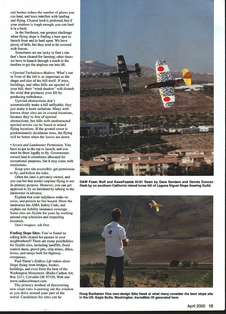
You've found no rolling hills cleared for pasture in your neighborhood? There are many possibilities for flyable sites, including landfills, flood control dams, gravel pits, strip mines, dikes, levees, and ramps built for highway overpasses.
Paul Naton's Endless Lift videos show slope flying from bridges, bushes, buildings, and even from the base of the Washington Monument. (Radio Carbon Art, Box 2311, Corvallis OR 97339; Web site: www.radiocarbonart.com).
The primary method of discovering new slope sites is peering out the window as you drive around your part of the world. Candidates for sites can be discovered by studying topographic maps of your area—paper maps or a computerized national topographic map like DeLorme’s Topo USA program (DeLorme Map Company, Two DeLorme Dr., Yarmouth ME 04096; Tel.: (207) 846-8900; Fax: (207) 846-7051; Web site: www.delorme.com).
You may be lucky enough to have a soaring club in your area, or knowledgeable hobby shop people who can point you toward local slope sites. I have gotten productive leads by querying hikers, hunters, and fishermen.
You can find model clubs in your area by checking the AMA Web site (www.modelaircraft.org) and clicking on the Chartered Clubs listing in the Membership Area.
Using the Internet to Find Slopes
In recent months the Internet has become a productive source for finding slope sites—for those in your local area, and for fliers who take slope models on trips.
I’ve seen two types of Internet functions that have begun to address this issue; first...
Sample Internet Slope Sites
California
- California Slope Racers — www.geocities.com/MotorCity/3839/race.htm
- Inland Slope Rebels — ourworld.compuserve.com/homepages/ISRI/SRSites.htm
- Temple Hill Slope Squadron — home.earthlink.net/~windrider007/siterew.html
- Charles River Radio Controllers — charliesriverrc.org/fields_californiaslopes.htm
- San Francisco Bay Area — ourworld.compuserve.com/homepages/dlstone/
Florida
- Soaring the beach condos — http://www.ov-1boronco.net/users/merlin/Flight/slopesoar.htm
Hawaii
- Maui — homepages.msn.com/HobbyCT/SoarMaui/index.html
Maryland
- Jefferson Slope Site — Capitol Area Soaring Society — home.att.net/~charles.french/CASA/JEFindex.html
Massachusetts
- Charles River Radio Controllers; Cape Cod — charlesriverrc.org/fields_capecodslopes.htm
- Charles River Radio Controllers; Mt. Watatic — crrc.addr.com/flysitess_mtwatactic.htm
Maine
- Cadillac Mountain, Mount Desert Island — www.charlesriverrc.org/fields_maineslopes.htm
New York
- Rainbow Lake (Buffalo area) — Clarence Sailplane Society — www.paradox.net/homepages/mtimm/directns.html
New Hampshire
- Morningside Flight Park — biz.fcgenetworks.net/morningside/morningside.htm
Nevada
- Reno Slope Site — www.srrollersander.com/Soaring-Red-Rock.htm
North Carolina
- Outer Banks Slope Sites — www.people.virginia.edu/~jiv5k/flysand.htm
Oregon
- Portland Area Soaring Society — www.europa.com/~patch/pass/passinfo.html
Pennsylvania
- Breezy View (Chickie’s Rock) — Baltimore Area Soaring Society — www.soarnd.org/FlySites/mpbzyrw.html
Washington State
- Eagle Butte and Kiona Butte — www.reddata.com/sass/eagle_and_kionabuttes.htm
- Seattle Area Soaring Society — www.reddata.com/sass/sites.htm
Virginia
- Blue Ridge Mountain Slope Sites — www.people.virginia.edu/~jiv5k/blue_ridge_slope_sites.htm
Fort Funston Web Camera (check the weather at this San Francisco slope)
For more leads:
- Planes, Wings, and Things: Soaring Super Links — www.planes-wings-things.com/links/links.htm
These are specific Web sites, and the second is a Listserv known as the RC Soaring Exchange.
Please note that the Internet is a dynamic and ever-changing source of information. Web sites appear and disappear; services come and go, change and evolve. The information presented was current and correct at the time of this writing, but may have changed by the time you read the article.
The way to accommodate the changing nature of the Internet is to make use of the search engines like Yahoo, Excite, and AltaVista. You can find this information and more by entering "slope soaring" into an online search engine.
We are indebted to leading soaring clubs and dedicated individuals for gathering and posting this information. We are further appreciative of the RC Soaring Exchange, an Internet "Listserv" that collects E-mail messages and re-mails them to all subscribers to the list. To start receiving RCSE Listserv messages, send an E-mail with "subscribe" in the body of the message to [email protected].
As I write this paragraph, there are approximately 1,200 RCSE subscribers, and this week there is a discussion of nominations for the best slope soaring sites in California. Who knows, next week's discussion could center on top sites in Pennsylvania or Kansas. (I've flown one reservoir site in Kansas, and I understand there are three more flyable reservoirs there.) A query posted to RCSE might lead you to a top site within a half-day's drive of your house.
Experienced sailplane fliers know the value of subscriptions to specialized publications. Pertinent to this discussion is Tom Nagel's "Have Sailplane Will Travel" column in RC Soaring Digest. Tom's column presents a soaring location in each issue (generally, a slope soaring location) suitable for flying on a vacation trip.
To find out about starting an RCSD subscription, send an E-mail to [email protected] or drop a note to publisher Judy Slates; Box 2108, Wylie TX 75098. You may wish to inquire about the availability of back issues that include Tom's informative column.
Parting Thoughts
It's easier to learn slope flying on a known good flying site, then take your flying skills to lesser sites. If you're totally new to slope soaring, you might want to try it first at Torrey Pines CA, Wilson Lake KS, Sleeping Bear Dunes at Traverse City MI, or Jockey's Ridge on the Skyline Drive in NC—perhaps with the support and encouragement of pilots who fly these sites every day that the wind's right.
We need a hill and the wind to fly slope, and although we tend to concentrate on the hill part of the equation, the wind may be even more important. You can fly a crummy hill in great wind, but you can't fly a super hill if the wind's too light, or blowing from the wrong direction.
To help your slope-finding efforts, begin building a mental database of wind speed and direction observations. Soon you'll know the prevailing winds in your area, and this knowledge will help in your search for good sites—it will allow you to concentrate on sites that face common wind directions.
For wind forecasts, take note of your local TV weather forecasters who tend to give detailed wind forecasts, and note whether their forecasts tend to be accurate.
The Internet gives us access to many sources of weather observation and forecast data. One of my favorites is the WindCast maps on www.intellicast.com.
Testing a new site may be tough on airplanes until you discover where the strongest lift is and where the best landing sites are. You can relaunch more times if you're flying a tough sailplane; the Bob Martin Coyote with its Dura-Lene® fuselage, and the Dave's Aircraft Works Schleicher 1-26, made of tough EPP foam, and the Bowman Hobbies Comanche, also of EPP-foam, are three of my current favorites, but there are many suitably tough airplanes. MA
Transcribed from original scans by AI. Minor OCR errors may remain.

